Galapagos Islands (Ecuador Galapagos Province)
Cruise Port schedule, live map, terminals, news
Region
South America
Local Time
2024-04-16 01:07
 77°F
77°F 24.9°C

 Light breeze
2 m/s
 83 °F / 29 °C
 75 °F / 24 °C
Port Galapagos Islands cruise ship schedule shows timetable calendars of all arrival and departure dates by month. The port's schedule lists all ships (in links) with cruises going to or leaving from Galapagos Islands, Ecuador Galapagos Province. To see the full itineraries (ports of call dates and arrival / departure times) and their lowest rates – just follow the corresponding ship-link.
| Day | Ship | Arrival | Departure |
|---|---|---|---|
| 31 March, 2024 Sunday | |||
| 7 April, 2024 Sunday | |||
| 14 April, 2024 Sunday | |||
| 21 April, 2024 Sunday | |||
| 28 April, 2024 Sunday |
The Galapagos Islands archipelago consists of 13 big and several hundred small isles located in the Pacific Ocean. Their location is on or near the equator, approx 1050 km (650 mi) off Ecuador's western coast. The islands are volcanic in origin, with mountainous interiors and flat shorelines culminating in high, central-location craters, some of which rising to over 5000 ft (1520 m). Several of the volcanoes are active.
Galapagos islands are fringed with mangroves. In other coastal areas the vegetation consists mainly of cactus, mesquite and thorn trees. In the exposed to heavy mist uplands, the flora is much more luxuriant. Climate and water temperatures are modified by Antarctica's cold Humboldt Current.
The Galapagos group is famous for its fauna. Unique to the archipelago are 6 giant tortoise species, burrowing land lizards and an unusual marine lizard that dives into the ocean for seaweed. The islands contain 85 different bird species, including flightless cormorants, flamingos, finches, penguins. Sea lions are numerous, as are different shore fish.
The Galapagos region's capital city is Baquerizo Moreno (on San Cristobal Island), but Puerto Ayora (on Santa Cruz Island) is considered the group's commercial center.
The islands were discovered in 1535 and first called "Las Encantadas" ("The Enchanted"). Pirates, explorers, seals- and whale hunters all visited before the colonization began in 1832. Charles Darwin, traveling on the ship HMS Beagle, spent 6 weeks in 1835 studying the Galapagos' fauna. His observations furnished considerable data for his thesis on natural selection "Origin of Species" (published 1859).
On January 14, 2022, Ecuador’s President (Guillermo Alberto Santiago Lasso Mendoza) signed a decree that established the new Hermandad Marine Reserve. This way, the existing Galapagos Marine Reserve was expanded by ~50% (with additional ~23000 mi2/60,000 km2 of ocean area) extending northwest to Ecuador’s maritime border with Costa Rica. This area (aka Cocos-Galapagos Swimway) is a migratory corridor used by marine species like whales, sharks, stingrays, sea turtles.
Among the major cruise companies that offer Galapagos itineraries are Celebrity, Silversea, DCL-Disney, G Adventures, Metropolitan Touring.
The newest boats deployed year-round in the region are Silver Origin (2021) and Celebrity Flora (2019).
Follows the list of all Galapagos Islands (main and minor isles).
Baltra Island (aka South Seymour) is flat and located near the center of the archipelago. The island's vegetation consists of salt bushes, prickly pear cacti, palo santo trees.
Bartolome Island (aka Bartholomew) is located off Santiago Island's east coast. It is one of the few isles having the Galápagos penguin - the only wild penguin species living on the equator. Another animal is the green turtle.
Darwin Island (aka Culpepper) is named after Charles Darwin (1809-1882). It has a total area of 1,1 km2 (0,4 mi2) with highest elevation point 168 m (551 ft). Here can be seen fur seals, frigatebirds, swallow-tailed gulls, marine iguanas, marine turtles, sea lions, whales, boobies (red-footed and Nazca).
Espanola Island (aka Hood) is named after Spain. The "Hood Island" alternative name honors Viscount Samuel Hood. The island has a total area of 60 km2 (23 mi2) with highest elevation point 206 m (676 ft). It is the Galapagos' southernmost isle. Due to its remote location, it has a large number of endemic species, including lava lizards, mockingbirds, tortoises. Other species represented here are marine iguanas, nesting waved albatross. The island has two landing points - Gardner Bay (swimming, snorkeling, beach) and Punta Suarez (wildlife watching - marine iguanas, lava lizards, hood mockingbirds, swallow-tailed gulls, blue-footed boobies, Nazca boobies, red-billed tropicbirds, hawks, waved albatross).
Fernandina Island (aka Narborough) was named to honor King Ferdinand II, the sponsor of the Columbus voyage. It has a total area of 642 km2 (248 mi2) with highest elevation point 1494 m (4902 ft). This is the archipelago's westernmost isle. At Punta Espinosa gather hundreds of marine iguanas, largely on its black lava rocks. Here can be seen also the flightless cormorants, penguins, pelicans, sea lions, fur seals. The island also features mangrove forests.
Floreana Island (aka Charles or Santa María) was named after Juan Jose Flores (1800-1864) - Ecuador's first President, during whose administration Ecuador took possession of the Galapagos archipelago. The alternative "Santa Maria" island name honors one of Columbus' ships. The island has a total area of 173 km2 (67 mi2) with highest elevation point 640 m (2100 ft). Its fauna is represented by flamingos, nesting green sea turtles, petrels (seabird). Near Floreana is the small Champion Isle.
Genovesa Island (aka Tower) was named after Genoa Italy, where Christopher Columbus was born. The isle is nicknamed "the bird island" and has a total area of 14 km2 (5,4 mi2) with highest elevation point 76 m (249 ft). At Darwin Bay can be seen frigatebirds and swallow-tailed gulls (the world's only nocturnal gull species). The fauna is also represented by boobies (red-footed), noddy terns, lava gulls, storm petrels, finches, some tropic birds and even doves. Prince Philip's Steps is a bird-watching site with boobies (red-footed and Nazca species). The island also features a large forest (named Palo Santo).
Isabela Island (aka Albemarle) was named after Queen Isabella II of Spain (1830–1904). It is the Galapagos' largest island, with a total area of 4640 km2 (1792 mi2) with highest elevation point Volcan Wolf (1707 m / 5600 ft). Here can be seen penguins, marine iguanas, flightless cormorants, pelicans, Sally Lightfoot crabs, land iguanas, tortoises, Darwin finches, hawks, doves. On this island (its southeastern tip) is located the Galapagos' 3rd-largest settlement - Puerto Villamil. This is also the world's only island where the equator runs across it.
Marchena Island (aka Bindloe) - named after Fray Antonio Marchena, it has a total area of 130 km2 (50 mi2) with highest elevation point 343 m (1125 ft). Here can be seen mainly hawks and sea lions, as well as the endemic Marchena lava lizards.
North Seymour Island was named after the British Navy officer Lord Hugh Seymour (1759-1801). It has a total area of 1,9 km2 (0,7 mi2) with highest elevation point 28 m (92 ft). The island is populated by blue-footed boobies and swallow-tailed gulls, both represented in large colonies. It also has hosts one of the world's largest frigatebird populations.
Pinzon Island (aka Duncan) was named after the Pinzon brothers, who were the captains of the Columbus ships Pinta and Nina. it has a total area of 18 km2 (7 mi2) with highest elevation point 458 m (1503 ft).
Pinta Island (aka Louis) was named after the Pinta ship, it has a total area of 60 km2 (23 mi2) with highest elevation point 777 m (2549 ft). Here can be seen sea lions, hawks, giant tortoises, dolphins, marine iguanas, Pinta Island had the last remaining colony of Pinta tortoises. The last remaining species were moved to Santa Cruz Island (Charles Darwin Research Station), where the attempt to breed them failed. The last tortoise died in June 2012.
Rabida Island (aka Jervis) was named after the Rabida convent, where Columbus left his son (Diego Columbus) during the Americas voyage. It has a total area of 4,9 km2 (1,9 mi2 with highest elevation point 367 m (1204 ft). Here can be seen white-cheeked pintail ducks (living in a saltwater lagoon located close to the beach), also nesting brown pelicans and boobies, as well as 9 species of finches.
San Cristobal Island (aka Chatham) was named after Saint Christopher - the seafarers' patron saint. It has a total area of 558 km2 (215 mi2) with highest elevation point 730 m (2395 ft). This is the first island visited by Charles Darwin during his Beagle ship expedition. Here can be seen frigatebirds, giant tortoises, sea lions, boobies (blue- and red-footed), marine iguanas, tropicbirds, dolphins, swallow-tailed gulls. Here is also the Galapagos' largest freshwater lake - Laguna El Junco. On the island's southern tip is the port town Puerto Baquerizo Moreno.
Santa Cruz Island (aka Indefatigable) - the name means Holy Cross in Spanish, The English alternative name honors the British ship HMS Indefatigable. It has a total area of 986 km2 (381 mi2) with highest elevation point 864 m (2834 ft). This island has the Galapagos' largest human population - the port town Puerto Ayora, where are the Charles Darwin Research Station and the Gaaápagos National Park Service's headquarters. In the isle's highlands can be seen lava tunnels, with a large population of tortoises. The Black Turtle Cove site features mangroves, sea turtles, stingrays, small sharks. Here is also located the famous Cerro Dragon lagoon with its flamingos. Along the walking trail can be seen land iguanas. Northwest of Santa Cruz is located Isla Guy Fawkes - two crescent-shaped uninhabited isles. Close/off Santa Cruz is Isla Plaza Sur/South Plaza Island (sized 0,13 km2/0,05 mi2) popular for its extraordinary flora and fauna (seabirds like sea bluffs, swallow-tailed gulls, red-billed tropicbirds, as well as land iguanas, marine iguanas, hybrid iguanas).
Santa Fe Island (aka Barrington) was named after a Spanish city, it has a total area of 24 km2 (9 mi2) with highest elevation point 259 m (850 ft). The island features an Opuntia cactus forest (the archipelago's largest), shear-waters petrels, swallow-tailed gulls, land iguanas, lava lizards, red-billed tropicbirds.
Santiago Island (aka San Salvador, and St James) - the names honor Saint James and the San Salvador Island (the first Caribbean island discovered by Columbus). It has a total area of 585 km2 (226 mi2) with highest elevation point 907 m (2976 ft). Here can be seen sea lions, fur seals, marine iguanas, turtles (both land and sea), finches and hawks, as well as flamingos, dolphins, sharks. Close to Santiago (to the southeast) is located the Chinese Hat Island - an excellent snorkeling destination.
Wolf Island (aka Wenman) was named after Theodor Wolf (1841-1924, a German geologist). It has a total area of 1,3 km2 (0,5 mi2) with highest elevation point 253 m (830 ft). Here can be observed fur seals, frigatebirds, boobies (Nazca and red-footed), swallow-tailed gulls, marine iguanas, as well as sharks, whales, dolphins, and the vampire finch (only found here).
Daphne Island (located north of Santa Cruz and west of Baltra) is the location of a large finch colony, studied for over 20 years by the British evolutionary biologists Peter Raymond Grant and Barbara Rosemary Grant. Other birds here are boobies (blue-footed, and Nazca), short-eared owls, Galapagos martins, red-billed tropical birds, frigatebirds.
South Plaza Island (aka Plaza Sur) was named after General Leonidas Plaza (1865-1932, one of Ecuador's presidents). It has a total area of 0,13 km2 (0,05 mi2) with highest elevation point 23 m (75 ft). The island's flora and fauna include the Opuntia cactus, iguanas (land and marine), birds (including tropical, and swallow-tailed gulls).
Nameless Island is used mostly for scuba diving.
Mosquera Island (between Baltra and North Seymour) has one of the world's largest Sea Lion populations.
Eden Island (aka Isla El Eden) is located northeast and close to Santa Cruz Island. It is approx 600 m (1968 ft) in diameter, with a total area of around 0,23 km2 (0,09 mi2) and highest elevation point 71 m (233 ft). It is among the Galapagos' best fishing and adventure tourism locations.
Galapagos Islands cruise terminal
Most Galapagos cruise ships depart from Baltra Island. Until 1986, Baltra had the only Galapagos airport. Now, the airports are two - one (on Baltra) for flights from South America, and the other (on San Cristobal) serving the whole archipelago. Private planes to Galapagos also fly to Baltra, as its airport is the only one offering overnight aircraft service.
Next map of Galapagos Islands cruise itineraries shows the two main routes and all island stops (ports / landing sites) in the archipelago.
Flights to Baltra include immediate bus shuttle transportation to one of the island's 2 docks.
- The first dock is in a small bay, and serves all the Galapagos cruise ships and tourist boats.
- The second dock serves the local ferries (between Baltra and Santa Cruz).
Baltra was established during WW2 (1939-1945) as an US Army Air Force base. The stationed here flight crews patrolled the eastern Pacific Ocean searching for German submarines and providing protection for the strategic Panama Canal.
The following map of Galapagos Islands also shows the list of animals that can be seen on each island.
- Cruise Industry
Viking expands World Cruise offerings with Longitudinal routes
Viking OCEAN has unveiled two fresh additions to its World Cruises, catering to travelers eager to explore the globe in the luxurious comfort...
April 2, 2024 - Cruise Industry
Aqua Expeditions launches rare culinary voyages with renowned chefs
Aqua Expeditions offers a range of extraordinary voyages, yet some stand out as particularly rare and exceptional experiences. This year, esteemed...
March 22, 2024 - Cruise Industry
HX-Hurtigruten Expeditions becomes all-inclusive cruise line
HX (Hurtigruten Expeditions), recognized globally as leaders in expedition cruising, have unveiled their plans to elevate the onboard guest...
March 20, 2024 - Cruise Industry
HX-Hurtigruten Expeditions unveils extensive 2025-2026 itinerary overhaul
HX (Hurtigruten Expeditions) has unveiled its 2025-2026 season, introducing new ports, landings, and itineraries across five continents. With 80...
January 16, 2024 - Accidents
Galapagos cruise operator suspends sailings amidst escalating violence in Ecuador
In response to an escalating wave of violence attributed to drug gangs in Ecuador, at least one Galapagos cruise operator has opted to suspend...
January 13, 2024 - Cruise Industry
HX and Hurtigruten unveil distinctive new brand identities and elevated guest experiences ahead of...
HX and sister brand Hurtigruten are revealing the next phase of their new brand identities, building upon the initial announcement in September. In...
December 18, 2023 - Cruise Industry
Windstar unveils first-time cruises in South America beginning December 2025
The ultra-premium travel brand Windstar Cruises introduces inaugural cruises in South America, set to commence in December 2025 with the all-suite...
November 18, 2023 - Cruise Industry
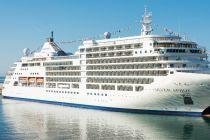
Silversea opens exclusive pre-sale on 206 cruises scheduled for summer 2025
Silversea Cruises has launched an exciting pre-sale opportunity for their summer 2025 collection, featuring a total of 206 voyages scheduled to...
September 9, 2023 - Cruise Industry
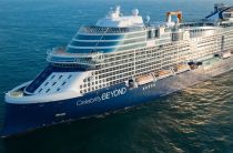
Celebrity Cruises removes prepaid gratuities from inclusive packages
Celebrity Cruises, a distinguished premium cruise line under the umbrella of the Royal Caribbean Group, has unveiled a series of strategic...
August 31, 2023 - Cruise Industry
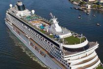
Bookings open for Crystal Serenity's 2025 World Cruise
On August 30th, Crystal Cruises will commence the reservation process for a global voyage aboard Crystal Serenity set for 2025. The cruise, spanning...
August 12, 2023 - show more news
