

Baffin Island (Nunavut Canada)
Cruise Port schedule, live map, terminals, news
Region
Arctic - Antarctica
Local Time
2026-09-27 16:42
 37°F
37°F 2.5°C

 Mod. breeze
6 m/s
 37 °F / 3 °C
 34 °F / 2 °C
Port Baffin Island cruise ship schedule shows timetable calendars of all arrival and departure dates by month. The port's schedule lists all ships (in links) with cruises going to or leaving from Baffin Island, Nunavut Canada. To see the full itineraries (ports of call dates and arrival / departure times) and their lowest rates – just follow the corresponding ship-link.
| Day | Ship | Arrival | Departure |
|---|---|---|---|
| 3 September, 2026 Thursday |  Viking Polaris Viking Polaris | ||
| 3 September, 2026 Thursday |  Le Lyrial Le Lyrial | ||
| 4 September, 2026 Friday |  Ocean Explorer Ocean Explorer | ||
| 5 September, 2026 Saturday |  Silver Wind Silver Wind | 06:00 | 08 Sep, 18:00 |
| 5 September, 2026 Saturday | L'Austral | 12:00 | 16:00 |
| 6 September, 2026 Sunday |  MS Roald Amundsen MS Roald Amundsen | ||
| 7 September, 2026 Monday | MS Roald Amundsen | ||
| 10 September, 2026 Thursday | Viking Polaris | ||
| 10 September, 2026 Thursday | Silver Wind | 14:00 | 18:00 |
| 12 September, 2026 Saturday | Le Lyrial | 12:00 | 18:00 |
| 13 September, 2026 Sunday | Silver Wind | 07:00 | 19:00 |
| 15 September, 2026 Tuesday | Viking Polaris | ||
| 16 September, 2026 Wednesday |  Seabourn Venture Seabourn Venture | 07:00 | 12:00 |
| 22 September, 2026 Tuesday | Viking Polaris | ||
| 22 September, 2026 Tuesday | L'Austral | 12:00 | 18:00 |
| 23 September, 2026 Wednesday | Seabourn Venture | 07:00 | 16:00 |
| 27 September, 2026 Sunday | Viking Polaris |
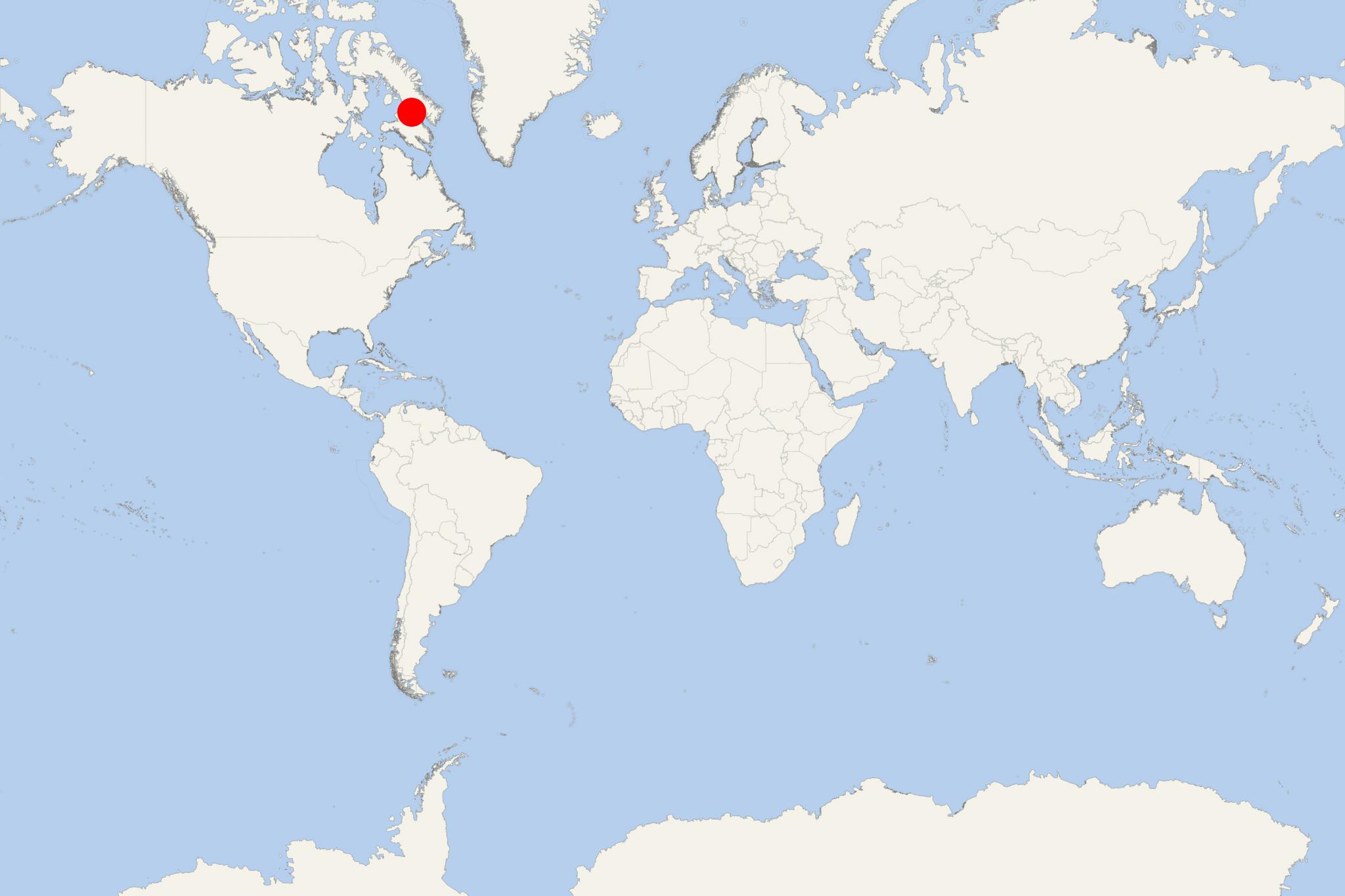
Baffin Island in the Nunavut region is Canada's largest and the world's 5th largest island (after Greenland, New Guinea, Borneo, and Madagascar). Its land area is 507451 km2 (195928 mi2) with a population of around 11000. Nunavut's capital, Iqaluit (fka Frobisher Bay) is located on the island's southeastern coast. Baffin Island is among the Arctic Ocean territories along the Northwest Passage route.
The list of "Canada top 10" largest islands (world rank in brackets) includes Baffin Island (5), Victoria Island (8), Ellesmere Island (10), Newfoundland (16), Banks Island (24), Devon Island (27), Axel Heiberg Island (32), Melville Island (33), Southampton Island (34) and Prince of Wales Island (40). All of them (excepting Newfoundland - in Newfoundland-Labrador) are located in the Nunavut- Northwest Territories of Arctic Canada.
Baffin Island has two large lakes - Nettilling and Amadjuak. Being a popular destination for Arctic wildlife watching, Baffin Island is famous with its Arctic foxes and polar bears (all along its coast), Arctic hares and lemmings (throughout), Arctic wolves, stoats, beluga whales, ringed seals, various nesting birds (snowy owl, gyrfalcon, snow goose, Canada goose).
Iqaluit is the Nunavut state's capital and largest town with a population of around 7000. It was named Frobisher Bay until 1987. Iqaluit, like all Nunavut settlements, has no road, rail or shipping connections to the rest of Canada.
Clyde River (aka Kanngiqtugaapik) is located on the Patricia Bay. The town has a population of around 1000, Northern Stores, town hall, an Anglican church, hospital, school, hotel, arena. It is served by the Clyde River Airport with regular flights to Pond Inlet and Iqaluit.
Pangnirtung (aka Pangniqtuuq) is located on the coast of the Pangnirtung Fjord. The town (sized 7,8 km2 / 3 mi2) has a population of around 1500. Pond Inlet is an Inuit community (population around 1500) located on the island's northern coast.
Other popular tourist destinations on Baffin Island are:
Niginganiq (aka Igaliqtuuq or Isabella Bay) is located on the island's northeast coast, near the Clyde River village. The Isabella Bay area in late summer / early fall is a feeding and resting stopover for a large proportion of bowhead whales. During this time, around 200 bowhead whales inhabit the area.
Baffin Bay (located between the island and Greenland's southwest coast) is a marginal sea connected to the Atlantic Ocean via Nares Strait. Due to floating ice packs and icebergs, the bay is navigable only in the summer.
Hoare Bay is located on the Cumberland Peninsula's southeastern portion.
North Arm Fjord is on the island's northwest coast. Here can be seen majestic mountains and glaciers, beautiful valleys, and wildlife (migratory birds).
Sam Ford Fiord is an elongated fjord located on the island's northeastern coast. Nearest settlements are Pond Inlet (some 320 km / 200 mi northwest) and Clyde River (some 80 km / 50 mi east).
Grinnel Glacier is located on the island's southwestern corner, southwest of Kimmirut,
The Arctic Circle crosses the Cumberland Peninsula (in the island's southeastern part) with the Labrador Sea to the southeast and the Davis Strait to the east (between the Cumberland Peninsula and Greenland). Also part of Baffin Island is the Hall Peninsula, separated from the Cumberland Peninsula by the Cumberland Sound (to the southwest). Cumberland Peninsula is part of the Arctic Tundra biome (formation of plants and animals with common characteristics due to the similar climate). This is the Earth's coldest and driest biome, as is in all parts of Baffin Island. The peninsula's terrain is mountainous. Mount Odin (near the Arctic Circle) has a height of 2147 m (7044 ft). Also part of the peninsula is Pangnirtung (aka Pangniqtuuq - an Inuit settlement on the southwestern coast) and the Auyuittuq National Park (translated as "the land that never melts").
Auyuittuq National Park (est 1976, a full national park since 2000, total area 19089 km2) is well known for its typical Arctic wilderness, featuring fjords, glaciers, ice fields, little vegetation, and very scarce wildlife (only 12 mammal species). On the park's territory are located the Inuit hamlets Pangnirtung and Qikiqtarjuaq Island (aka Broughton Island).
Off the Foxe Peninsula (Baffin's western part) is located the famous for its Thule culture Cape Dorset Island, which together with Mallik Island form the Mallikjuaq Territorial Park.
Note: All Northwest Passage ship transits are assisted by a Canadian icebreaker or other vessels with an ice-strengthened hull.
Baffin Island is not a single conventional cruise port. It is a vast Arctic destination with several Inuit communities, fjords and remote landing sites. The exact experience depends entirely on the location selected by the expedition team. Most visits involve Zodiac transfers rather than a walk-off berth, and plans may change because of wind, sea, ice or wildlife conditions.
At a Glance
- Independent sightseeing: Limited and generally not recommended outside a community.
- Best approach: Join the ship’s expedition activities and follow the guides ashore.
- Typical access: Ship at anchor, followed by a Zodiac transfer to a beach or community landing.
- Main experiences: Guided tundra walks, Zodiac cruising, wildlife observation, Arctic scenery and visits to Inuit communities.
- Important limitation: There are no roads connecting Baffin Island’s communities, so distant attractions cannot be visited independently during a port call.
Getting Ashore
There is no central Baffin Island cruise terminal. Expedition ships normally anchor near the day’s intended landing site and transfer passengers in small boats. Landings can involve wet or uneven ground, loose stones, mud, snow or surf.
At community calls such as Pond Inlet, Pangnirtung, Clyde River or Kinngait, the landing point may be within walking distance of local facilities. Transport, tours and cultural programs are normally coordinated in advance by the cruise operator and community. Do not expect taxis, scheduled sightseeing buses or conventional visitor infrastructure.
Best Ways to Spend the Call
Join a Guided Tundra Landing
At an uninhabited site, the expedition team may lead a short or moderate walk across tundra, rocky shoreline or elevated ground. These landings offer views of fjords, mountains, glaciers and Arctic vegetation. Routes are chosen on the day according to weather, terrain and wildlife activity.
Practicality: Organized excursion recommended. Polar-bear risk and the absence of marked trails make independent walking inappropriate.
Take a Zodiac Cruise
Where going ashore is unsuitable, the ship may operate guided Zodiac trips along cliffs, glacier fronts or sheltered fjord coastlines. This can be the most practical way to observe ice formations, seabirds and marine wildlife while maintaining a safe distance.
Practicality: Available only through the ship and dependent on local conditions.
Visit an Inuit Community
Community calls may include a guided settlement walk, cultural presentation, visitor center, craft demonstration or an opportunity to purchase locally made carvings, prints and textiles. Pond Inlet’s planned cruise visits, for example, can include the Nattinnak Visitor Centre and community cultural activities.
Practicality: Independent walking may be possible after landing, but the ship’s coordinated program is usually the most appropriate option. Activities and access vary by community and are not guaranteed.
Watch for Arctic Wildlife
Depending on the location and season, passengers may see whales, seals, seabirds, Arctic foxes or other wildlife. Sightings are never assured. Polar bears must be treated as a serious safety hazard rather than an attraction to approach.
Practicality: Wildlife observation should take place with the expedition team, from the ship or during a controlled Zodiac outing.
Walking Ashore
A fixed self-guided walking tour is not appropriate for the general Baffin Island call because the page covers many possible landing locations. At wilderness sites, remain with the expedition guides and inside any designated perimeter.
During an approved community visit, passengers may be able to walk between the landing area, visitor facilities, cultural venues and craft displays. Distances and routes vary, streets may be unpaved, and services can be limited. Follow the locally arranged route rather than entering private property or exploring beyond the settlement.
National Parks and Distant Sights
Auyuittuq and Sirmilik national parks are major Baffin Island attractions, but they are wilderness destinations rather than ordinary shore-call sightseeing stops. Reaching them can require boats, local outfitters, permits and considerably more time than a typical landing allows. Do not assume that a cruise call at Pangnirtung or Pond Inlet includes entry into the nearby park.
Locations elsewhere on the island cannot be reached by road from the landing community. Iqaluit, Pond Inlet, Pangnirtung and Kinngait should be treated as separate destinations, not interchangeable attractions for one port day.
Practical Tips
- Wear waterproof expedition boots and dress in warm, windproof layers; conditions can change quickly.
- Bring gloves, a hat and protection for cameras and binoculars during Zodiac transfers.
- Follow all instructions concerning wildlife, landing boundaries and biosecurity.
- Ask permission before photographing residents, particularly children.
- Do not enter homes, work areas or private property unless specifically invited.
- Carry only what you can manage safely while boarding a moving Zodiac.
- Allow the expedition team to manage return timing. Zodiac operations may be altered or suspended at short notice.
Baffin Island hotels
- Cruise Industry
HX Expeditions expands 2028-2029 schedule with 26 new itineraries
HX Expeditions has unveiled its 2028-2029 season, featuring 57 voyages across 14 destinations worldwide, including 26 new itineraries, 2 destinations...
September 16, 2026 - Cruise Industry
HX Expeditions launches Artist in Residence programme with Arctic voyage debut
HX Expeditions has introduced its first Artist in Residence programme, a new initiative designed to bring creative professionals aboard selected...
June 19, 2026 - Cruise Industry
Seabourn schedules expanded 2028–2029 expeditions with pole-to-pole cruise
Seabourn has opened bookings for its 2028–2029 expedition program, presenting an extended series of voyages shaped by increased activity in...
April 24, 2026 - Cruise Industry
Hurtigruten introduces 93-day Arctic to Antarctica cruise 2022
The Norwegian brand Hurtigruten Expeditions announced the 93-day "Pole to Pole 2022 Expedition Voyage" scheduled to explore Alaska, the Canadian...
June 6, 2021 - show more news