

Culebra Island (Puerto Rico)
Cruise Port schedule, live map, terminals, news
Region
Bahamas - Caribbean - Bermuda
Local Time
2026-10-23 04:36
 84°F
28.7°C

 Gentle breeze
4.9 m/s
 85 °F / 30 °C
83 °F / 29 °C
Port Culebra Island cruise ship schedule shows timetable calendars of all arrival and departure dates by month. The port's schedule lists all ships (in links) with cruises going to or leaving from Culebra Island, Puerto Rico. To see the full itineraries (ports of call dates and arrival / departure times) and their lowest rates – just follow the corresponding ship-link.
| Day | Ship | Arrival | Departure |
|---|---|---|---|
| 12 March, 2028 Sunday |  SeaDream II |
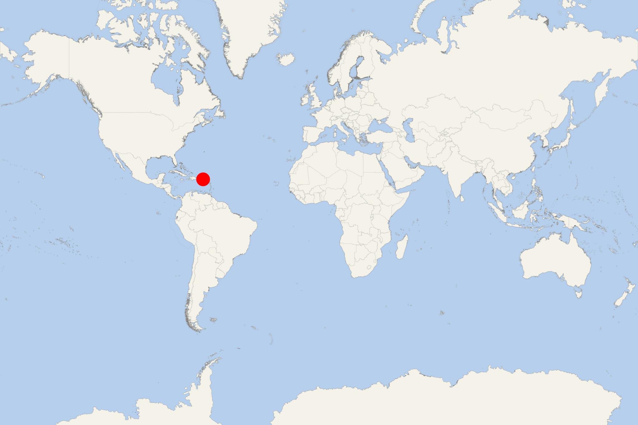
Isla Culebra Island (Culebra port locode PRCPX), aka Snake Island/Isla Chiquita/Ultima Virgen, is an island-municipality of Puerto Rico. The isle is located 17 mi (27 km) east of mainland Puerto Rico, 12 mi (19 km) west of St Thomas and 9 mi (14 km) north of Vieques. Culebra covers a total area of approx 30 km2 (12 mi2) and has population of around 1,800 people, ranking it the least populous municipality of Puerto Rico.
Culebra Island is spread over 5 wards, and Culebra Pueblo - port town and administrative center. Because of the island's arid nature, there is no run-off from streams or rivers, resulting in clear waters around the archipelago. Culebra is popular as a weekend (short-break) cruise destination for Americans and local residents (mainly from Vieques). The island features numerous beaches, among which is Playa Flamenco (also Marine Wildlife Reserve).
Until 1975, the lands west of Flamenco Beach was used for joint-US Navy/Marine Corps training (amphibious) exercises, including naval gunfire support and beach landings. Many military relics (including tanks) still remain in this region.
Many beaches on Culebra Island are only accessible via boats or private cars. Of the smaller isles, only Culebrita and Luis Pena permit tourists to visit via water taxis from Culebra. Nature photography, hiking and snorkeling are other popular activities. To protect the nature park, motor vehicles, camping and littering are not permitted. Year-round camping is allowed only on Playa Flamenco.
Cruise ships to Culebra Island dock (anchor) at Culebra, a port town on the southwestern coast. On the following map of Isla Culebra, you can see all the surrounding isles and the island's 5 barrios (neighborhoods) named Flamenco, San Isidoro, Fraile, Playa Sardinas 2 and Playa Sardinas 1.
Independent with some planning or transport. Culebra is best suited to a beach or snorkeling day. The small town of Dewey is easy to explore on foot, but the main beaches require transport. For a typical cruise call, choose one main beach and leave time for a short town walk rather than trying to tour the entire island.
Getting Ashore and Around
Cruise visits generally involve anchoring and tendering ashore. Confirm your ship’s landing point and last tender time before making independent arrangements; do not assume the public ferry terminal is your tender dock.
If you land in Dewey, the town’s shops and waterfront are within a short walk. Local taxis and shared vans serve Flamenco Beach, approximately 4 km (2.5 mi) from town, with a drive usually taking around 10–15 minutes. Arrange your return pickup before leaving the vehicle and confirm the fare.
A taxi is the simplest option for one beach. Reserve a vehicle ahead if you want to visit several locations, allowing time for collection and return. Walking from Dewey to Flamenco uses much of a short call and involves exposed roadside walking; a transfer is more practical.
Best Ways to Spend Your Time
Flamenco Beach: the Simplest Beach Day
Allow approximately 3–4 hours ashore for transport, swimming, a beach walk and a snack. Flamenco’s broad sandy bay makes it the most straightforward choice for visitors wanting one main activity. Food kiosks and bathroom facilities make it more convenient than the island’s secluded beaches, although availability can vary.
Explore a manageable section of the shoreline rather than committing to the whole beach. The old military tanks are a recognizable photo stop where access is permitted. Walking on soft sand is more tiring than walking around town, and swimming conditions must be checked on the day.
Tamarindo Beach: Guided Snorkeling
Tamarindo is a better choice for underwater wildlife than for a conventional sandy beach day. Its shoreline is rocky, and sea turtles may be seen offshore, although sightings are never guaranteed. Allow roughly 2–3 hours for a snorkeling outing and transfers, depending on the operator’s itinerary.
An organized excursion is recommended for inexperienced snorkelers. A local guide can help with entry points, conditions and wildlife etiquette. Confident swimmers can visit independently with their own equipment and a confirmed return ride. Bring water and supplies; there are no beach facilities. Keep your distance from turtles and avoid touching coral.
Dewey: a Short Walk and Waterfront Lunch
Dewey works well for a brief call, a low-key visit or an extra hour after the beach. Browse the small shops, see the canal and lift bridge, and stop for refreshments overlooking the water. Expect a compact working island town rather than a large shopping district or an extensive sightseeing circuit.
Offshore Islands: a Prearranged Boat Outing
Culebrita and Luis Peña offer beaches and marine scenery reached by boat. These outings require advance coordination and suitable sea conditions. Choose one only when the operator confirms that departure, landing arrangements and return fit your cruise call. A ship-arranged excursion, when offered, is a practical choice because an additional boat transfer adds uncertainty to a tender-port visit.
Self-Guided Walking Tour
Easy Dewey Waterfront Loop
Start: your landing point in central Dewey. Allow approximately 1–1.5 km (0.6–0.9 mi), depending on the dock, with 20–30 minutes of pure walking or 60–90 minutes including browsing and refreshments. The route is mostly level, but pavement can be uneven and sidewalks are intermittent.
- Landing area: identify your return dock and note the tender instructions before setting off.
- Bahía de Sardinas waterfront: view the ferry-side waterfront from public streets, keeping clear of loading areas.
- Central shopping streets: browse the small stores around Calle Pedro Márquez and pick up any beach supplies.
- Canal and lift bridge: continue to the bridge linking the two sides of town for views along the waterway.
- Ensenada Honda waterfront: stop at an accessible waterfront café or restaurant, then retrace your route to the landing point.
This is a short town stroll, not a walking route to the main beaches. Stay alert to vehicles near the bridge and allow extra time in the heat.
Practical Tips for Your Call
- Plan around the last tender: aim to reach the landing area at least 45–60 minutes before it, with more margin for remote beaches or boat trips. Follow any earlier deadline set by the ship.
- Confirm the return ride: agree on a pickup time and place, and save the driver’s contact details. Do not depend on finding a vehicle at a secluded beach.
- Check local access notices: former military training areas can have restricted sections or cleanup work. Respect fences and signs, and never touch unfamiliar metal objects.
- Bring essentials: water, sun protection, a towel and some US-dollar cash are useful. Carry everything you need for beaches without facilities.
- Keep the day manageable: Flamenco followed by a short Dewey walk is a practical combination. Add a second beach only with coordinated transport and ample time remaining.
Culebra Island hotels
- Cruise Industry
Scenic Cruises' superyachts (Azzurra, Sakara, Eclipse 2) deployed in the Caribbean in 2023
Scenic Group has announced that 3 of its superyachts - Emerald Azzurra, Emerald Sakara, and Scenic Eclipse II, will be sailing in the Caribbean...
July 25, 2023 - Cruise Industry
Emerald Cruises to homeport its superyachts Azzura and Sakara in the Caribbean for 2023-2024 winter...
Emerald Cruises announced it will homeport its 2 new 100-passenger yachts, Azzura and Sakara, in the Caribbean for the 2023 & 2024 winter seasons...
February 15, 2023 - Cruise Industry
SeaDream Cruises launches 2025 Caribbean, Mediterranean, Scandinavia/Northern Europe itineraries
SeaDream Yacht Club announced the opening of 2025 Caribbean, Mediterranean, Scandinavia & Northern Europe cruises on its newly renovated, 56...
January 23, 2023 - Cruise Industry
Scenic Eclipse 2023-2024 Caribbean Collection unveiled
The range of itinerary offerings on the superyacht Scenic Eclipse 1 got bigger as Scenic Cruises unveiled its 2023-2024 Caribbean Collection. The...
October 26, 2022 - show more news