

Chichagof Island (Alaska, Elfin Cove-Pelican)
Cruise Port schedule, live map, terminals, news
 40°F

 Light breeze

Port Chichagof Island cruise ship schedule shows timetable calendars of all arrival and departure dates by month. The port's schedule lists all ships (in links) with cruises going to or leaving from Chichagof Island, Alaska, Elfin Cove-Pelican. To see the full itineraries (ports of call dates and arrival / departure times) and their lowest rates – just follow the corresponding ship-link.
| Day | Ship | Arrival | Departure |
|---|---|---|---|
| 4 October, 2026 Sunday |  Safari Endeavour |
Chichagof Island (aka Shee Kaax) is located in Alaska's Alexander Archipelago. The island has length 75 mi (121 km) and width of 50 mi (80 km), with a total land area of 2049 mi2 (5306 km2), ranking it the USA's 5th largest and the world's 109th largest. Its coastline is 742 mi (1194 km). Its total population is around 1,500. This Alaskan Island has the world's highest population of bears (brown bears) per mi2.
Chichagof is the largest of Alaska's ABC Islands (Admiralty, Baranof, Chichagof). All three are located in the Alexander Archipelago and are part of the Tongass National Forest. Most of the islands' area is protected wilderness, with a minimal human presence on them. Chichagof is located directly north of Baranof, both being separated by the Peril Strait. Chichagof is bounded to the east by Chatham Strait, to the northeast by Icy Strait, to the northwest by Cross Sound and to the west by Gulf of Alaska.
The other (in the "USA top 10") largest Alaskan islands are Kodiak, Prince of Wales, Chichagof, St Lawrence, Admiralty, Nunivak, Unimak, and Baranof.
Chichagof Island's communities are named Elfin Cove, Hoonah, Pelican and Tenakee Springs. They all are located on the island's northern half. The primary economic sources for these villages include commercial fishing, charter fishing tours, boating, guided hunting tours, hiking, logging.
Hoonah (aka Xunaa) is located 30 mi (48 km) west of Juneau, across the Alaskan Inside Passage. Hoonah is the island's "first-class city", with a population of around 1000. Elfin Cove (in the northwestern part) has population of around 50 people. Pelican ((in the northwestern part) has population of around 200 people. The village is Pelican is located on the Lisianski Inlet's east side. The inlet opens into Lisianski Strait and Cross Sound. Tenakee Springs (in the western part) has population of around 100 people. The village is served by the Tenakee Seaplane Base (state-owned) and the Alaska Marine Highway (state-owned).
Tenakee Seaplane Base serves an average of 54 aircraft operations (to and from Juneau AK) per month, of which around 80% are air taxis.
Alaska Marine Highway is headquartered in Ketchikan AK and provides ferry services between the Aleutian Islands, Alaskan Inside Passage and British Columbia (Canada). Ferries serve Southeast Alaskan communities without road access. They transport passengers, vehicles and cargo. The operated routes go as far south as Bellingham WA and Dutch Harbor (Amaknak Island). There are a total of 32 ferry terminals in the three states (Alaska, Washington, and BC Canada). Due to the large distances between the ports, most ferries are built for multiple (up to 3-day) itineraries and larger ships have passenger cabins. All ferries have solariums, showers, sleeping lounges and serve hot food and beverages.
Point Adolphus (Gustavus) is located on the island's northernmost tip. This is a well-known viewing area for watching humpback whales. They come here in the summer from Mexico and Hawaii to feed. Point Adolphus' coastline is also perfect for sighting orca whales, sea lions, porpoises and various seabirds. Besides wildlife watching, other popular tourist activities here are fishing, sea kayaking, camping.
Chatham Strait
Chatham Strait is a narrow waterway (passage) in the Alexander Archipelago that separates Baranof Island and Chichagof Island (to the west) from Kuiu Island and Admiralty Island (to the east).
Chatham Strait has length of 240 km (150 mi) and width of 5-16 km (3-10 mi), extending southwards from the junction of Lynn Canal and Icy Strait to the open sea.
Chichagof Island cruise terminal
Most cruise ships to Chichagof Island anchor at Point Adolphus, on the island's northern tip. This location is known as an excellent whale watching area. Humpback whales come here from Mexico and Hawaii in the summer to feed. On the coastline here can be also seen sea lions, orca whales, sea birds. Among the most popular activities, beside wildlife viewing, are sea kayaking, fishing and camping.
However, Chichagof Island's most prefered port is Hoonah - on the northeastern coast.
Rarely, ships visit Elfin Cove (on the northwestern coast).
Planning Your Chichagof Island Call
Chichagof Island is usually an expedition-style wilderness stop rather than a conventional cruise port. The island has no single passenger terminal, and the exact anchorage or landing area may be chosen according to weather, tides, wildlife activity and local conditions. Small expedition ships commonly use Zodiacs or similar landing craft for shore access.
Independent sightseeing is limited. Most activities are arranged and supervised by the ship’s expedition team because landing sites are remote, roads are absent or disconnected, and coastal brown bears inhabit the island. If the itinerary specifically names Elfin Cove or another community, limited independent exploration may be possible after landing.
Getting Ashore
- Remote wilderness landing: Expect transport by Zodiac or expedition boat. Landings may be on a beach, rocky shoreline or simple local dock rather than at a cruise terminal.
- Elfin Cove: This tiny, roadless fishing community is accessible only by boat or floatplane. Buildings are connected by wooden boardwalks, making it easy to explore on foot once ashore.
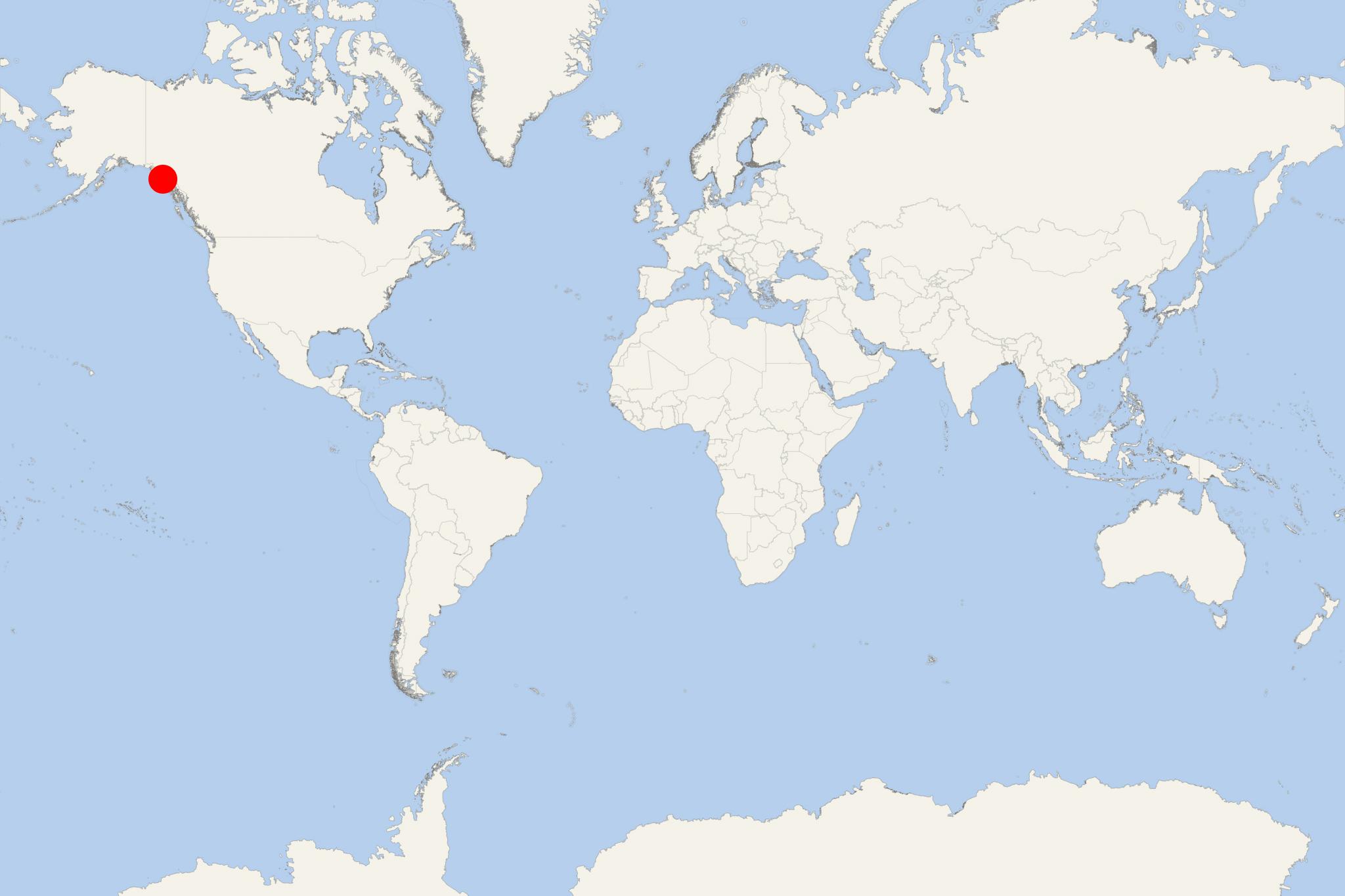
- Flexible operations: The captain and expedition leader may change the landing site, activity or timing at short notice. Follow onboard announcements rather than relying on the mapped port position.
Best Ways to Spend the Call
Explore the Coast by Zodiac
A guided small-boat cruise is one of the most practical ways to experience Chichagof Island. Routes may follow sheltered coves, forested shorelines and rocky outcrops while searching for sea otters, seals, bald eagles, whales and bears near the water. Wildlife sightings are never guaranteed. Allow roughly 1.5–3 hours, depending on the ship’s program and conditions.
Kayak in a Sheltered Cove
Some expedition itineraries offer ship-operated kayaking or paddleboarding. These activities provide close views of the intertidal zone and temperate rainforest but depend heavily on wind, swell and currents. Equipment, safety support and local guidance are essential; independent kayak rental should not be expected at a remote landing.
Join a Guided Rainforest Hike
A naturalist-led walk may explore shoreline, muskeg or dense Tongass rainforest. Trails can be muddy, uneven and obstructed by roots, rocks and fallen trees. Wear waterproof footwear and remain with the group: Chichagof Island is active brown-bear habitat, and remote hiking alone is not recommended.
Look for Coastal Brown Bears
Bear searches are best undertaken with trained guides who understand current animal activity and safe viewing practices. Late-summer salmon runs can improve viewing opportunities in some areas, but neither the landing location nor sightings can be predicted. Never approach a bear, leave the group or walk into the forest hoping to find one.
Visit Elfin Cove if Included in the Landing
Elfin Cove offers a contrasting experience to a wilderness landing. Passengers can follow the boardwalk through the small fishing community, see its harbor and working waterfront, and visit the local museum or businesses if they are open. Services are very limited and seasonal, so the village is best appreciated as a quiet community rather than a developed attraction.
Self-Guided Elfin Cove Boardwalk Walk
This route is suitable only when the ship lands at Elfin Cove and independent time ashore is permitted.
- Landing dock and inner harbor: Begin with views of fishing boats, floatplanes and homes built beside the protected water.
- Main boardwalk: Follow the wooden walkway through the roadless settlement.
- Post office and community buildings: Observe the practical infrastructure of this isolated fishing village without entering private property.
- Local museum: Visit if it is open during the call; hours can be informal or seasonal.
- General store and waterfront: Check for locally available refreshments or supplies, then enjoy views toward Cross Sound.
- Return to the landing dock: Retrace the boardwalk with ample time before the final boat departure.
Recommended time: 1–1.5 hours. Difficulty: Easy to moderate, although wet wooden surfaces can be slippery and some sections may be uneven. Stay on public boardwalks and respect residents’ privacy.
Practical Tips
- Dress in waterproof layers and carry gloves and a warm hat; conditions can change quickly even in summer.
- Use footwear with strong grip for wet decks, boardwalks, beaches and muddy forest terrain.
- Protect cameras and phones from spray during Zodiac transfers.
- Bring binoculars, but maintain the distances set by guides when observing wildlife.
- Do not carry exposed food during wilderness walks, and follow all expedition-team bear-safety instructions.
- Passengers with limited mobility should ask about the landing surface and Zodiac boarding procedure before leaving the ship.
- Allow a generous return margin. Small-boat operations can be delayed by weather, tides or wildlife, and only the ship’s team can coordinate a safe return.