Robinson Crusoe Island (Chile)
Cruise Port schedule, live map, terminals, news
Region
South America
Local Time
2026-02-01 12:07
 69°F
69°F 20.4°C

 Gentle breeze
5.3 m/s
 70 °F / 22 °C
 68 °F / 20 °C
Port Robinson Crusoe Island cruise ship schedule shows timetable calendars of all arrival and departure dates by month. The port's schedule lists all ships (in links) with cruises going to or leaving from Robinson Crusoe Island, Chile. To see the full itineraries (ports of call dates and arrival / departure times) and their lowest rates – just follow the corresponding ship-link.
| Day | Ship | Arrival | Departure |
|---|---|---|---|
| 23 February, 2026 Monday |
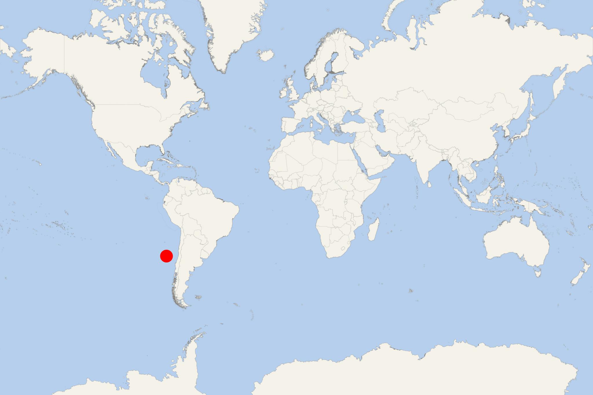
Robinson Crusoe Island (officially Isla Róbinson Crusoe, fka Isla Juan Fernandez, and Mas a Tierra) is the second largest in the Juan Fernandez Archipelago (Chile). The island is located in the southeastern Pacific Ocean, approx 180 km (112 mi) east of Alejandro Selkirk Island and approx 670 km (416 mi) west of San Antonio (mainland Chile).
With population of around 900, Isla Robinson Crusoe is the archipelago's most populous. The other inhabited island is Alejandro Selkirk.
In the 18th century, for a short period, Isla Juan Fernandez was a prison colony, then the island became again uninhabited before a permanent settlement (with around 50 people) was established in the late 19th century.
On this island lived in solitude the marooned (as a castaway) sailor Alexander Selkirk (aka Alexander Selcraig, 1676-1721). He lived alone on the island for a total of 4 years and 4 months and is thought to have inspired Daniel Defoe for the character in his "Robinson Crusoe Island" novel (published in 1719). All that the sailor had left with him was some clothing, a musket (muzzle-loaded firearm), gunpowder, some carpenter's tools, a knife and a Bible.
To attract international tourists to this location, the Chilean government renamed the island in 1966 from "Mas a Tierra" to "Isla Robinson Crusoe".
Robinson Crusoe Island is mountainous (with steep valleys and ridges) formed by lava flows built up from numerous volcanic eruptions. Its highest elevation is El Yunque (915 m / 3002 ft). In the southwestern part there is a narrow peninsula (called Cordon Escarpado). The small Santa Clara Island is located just off its southwestern coast.
The island's last volcanic eruption was in February 1835 - from a subsea vent 1,6 km (1 ml). The event was, however, minor, producing explosions and flames (lighting up the island) and small tsunamis. On February 27, 2010, the island was hit by a tsunami (3 m / 10 ft high wave) produced by an earthquake with magnitude 8,8. The accident resulted in 16 dead and most of the San Juan Batista's buildings being washed away.
The locals depend mainly on trading spiny lobsters. The island's amenities include few vehicles, satellite Internet, television. Tourists' number (including cruise ship passengres) is in the hundreds annually. Among the island's popular activities is scuba diving, particularly in the area of the German warship wreck Dresden (in Cumberland Bay). The ship was scuttled by its crew in 1915 (during WW1).
Cruise ships to Robinson Crusoe Island dock (anchor) at San Juan Bautista - port town on the northern coast, located at the Cumberland Bay.
- There is an airstrip near the tip of the southwest peninsula, with flights from the capital city Santiago de Chile (under 3 hours air-travel time). There is a ferry connecting the town with the airstrip.
- Cruise Industry
Seabourn Quest ship's 120-day “Cape to Cape” World Cruise 2028
Seabourn has outlined its 2028 Cape to Cape World Cruise, a 120-day global passage aboard Seabourn Quest that will span 5 continents and more than 50...
December 23, 2025 - Cruise Industry
HAL-Holland America Line announces 2027 Grand Voyages
HAL-Holland America Line has published the itineraries for its 2027 Grand Voyages, offering travelers the opportunity to either complete a 129-day...
April 26, 2025 - Cruise Industry
Fred Olsen unveils shorter itinerary segments for World Cruise 2025 (ship Bolette)
Explorers seeking their next adventure can take advantage of 3 new shorter sailings as part of Fred Olsen Cruise Lines' 2025 world cruise. The cruise...
July 10, 2024 - Cruise Industry
RSSC-Regent Seven Seas' ever-longest world cruise sold out in record time
RSSC-Regent Seven Seas Cruises sold out in record time their longest world cruise ever, spanning 36,295 nautical miles across 25 different...
June 22, 2022 - Cruise Industry

RSSC-Regent Seven Seas Cruises announce their longest world cruise ever
RSSC-Regent Seven Seas Cruises unveiled their longest world cruise ever, spanning 36,295 nautical miles across 25 different countries and 97 ports of...
May 26, 2022 - show more news
