

Chinese Hat Island (Galapagos)
Cruise Port schedule, live map, terminals, news
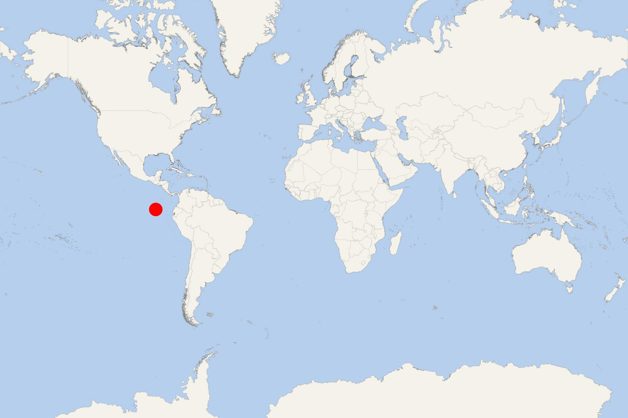
Region
Galapagos Islands
Local Time
2026-10-22 20:01
 80°F
26.7°C

 Gentle breeze
4 m/s
 83 °F / 29 °C
77 °F / 26 °C
Chinese Hat Island (officially Isla Sombrero Chino) is one of the smallest Galapagos Islands, located close to the Santiago Island and shaped like a Chinese hat. Sombrero Chino features an anchor, gorgeous beach, wildlife (marine iguanas, a sea lions colony), lava field and American Oystercatcher (wading birds with orange beaks).
Chinese Hat Island is an excellent snorkelling destination - calm water, white-tipped reef sharks, Galapagos penguins. The access to the island is restricted to select cruise ships only due to its fragile ecosystem.
A small sea lion cove is found on the north shore. Boats anchor and land there at the visitor site. A 400-meter trail goes around the cove and through the sea lion colony where marine iguanas dominate the landscape. The volcanic scenery is very attractive, and there are really good views of the cone. There are swimming and snorkeling opportunities in the cove.
Next photo explains perfectly why the island is called Isla Sombrero Chino.
Chinese Hat Island cruise terminal
The following map of Galapagos Islands cruise itineraries shows the two main routes and all island stops (ports / landing sites) in the archipelago.
Chinese Hat Island, also known as Sombrero Chino, is a small protected islet beside Santiago Island in the Galápagos. There is no town, road, pier or independent transport. Visits are tightly controlled and normally form part of a small-ship expedition itinerary, combining a guided nature walk with snorkeling or a panga ride.
At a Glance
- Access: Ship-to-shore transfer by panga or Zodiac, followed by a wet landing on a small sandy beach.
- Independent sightseeing: Not permitted. Visitors must remain with an authorized Galápagos National Park naturalist guide.
- Main experiences: Volcanic formations, coastal wildlife, snorkeling and scenic small-boat exploration.
- Typical difficulty: Easy to moderate, although the lava trail is rough and uneven.
Getting Ashore
Expedition vessels anchor offshore and transfer passengers in small inflatable boats. The landing is normally wet, meaning passengers step into shallow water before reaching the beach. Wear secure footwear that can get wet and follow the crew’s instructions when entering and leaving the panga.
There are no visitor facilities, shops, toilets, taxis or public transport ashore. Activities and timing are determined by the ship’s authorized itinerary, sea conditions and National Park regulations.
Best Ways to Spend the Visit
Guided Volcanic Shore Walk
The designated trail begins at the white-sand landing beach and follows the western side of the islet across young lava terrain. The route is approximately 400 m (0.2 mi) each way and is usually completed slowly with frequent stops for wildlife and geological interpretation.
Look for lava tubes, hardened flows, small pioneer plants and coastal wildlife such as sea lions, marine iguanas, Sally Lightfoot crabs and shorebirds. Galápagos penguins and hawks may also be seen, but sightings are never guaranteed.
- Recommended time: About 45–75 minutes, depending on wildlife stops.
- Difficulty: Easy to moderate.
- Terrain: Sand followed by sharp, irregular and potentially slippery lava.
- Access: Guided groups only; remain on the marked route.
Snorkeling in the Channel
The sheltered channel between Chinese Hat and Santiago Island is the principal marine attraction. Depending on conditions and the ship’s program, snorkeling may reveal reef fish, rays, sea turtles, sea lions, whitetip reef sharks or Galápagos penguins.
Currents, visibility and water temperature vary. Passengers should use the equipment and flotation aids provided by the expedition team and stay within the supervised snorkeling area. Those uncertain about swimming in open water can usually enjoy wildlife viewing from the panga instead.
Panga, Kayak or Paddle Excursion
Some expedition programs explore the shoreline by panga, kayak or paddleboard. These activities can provide close views of the lava coast and animals resting near the water without requiring a landing. Availability depends entirely on the vessel, permits and conditions on the day.
Guided Walking Route
Landing Beach to the Western Lava Shore
- Make the wet landing on the small white-sand beach.
- Pause near the beach to observe sea lions and coastal birds without approaching them.
- Follow the marked path onto the lava field.
- Examine lava tubes and other volcanic formations from the trail.
- Continue toward the western shoreline for views across the channel to Santiago Island.
- Return along the same controlled route to the landing beach and panga pickup point.
Distance: Approximately 800 m (0.5 mi) round trip. Pure walking time: About 20–30 minutes. Recommended total time: 45–75 minutes with guided stops. This is not a self-guided walk; leaving the marked trail is prohibited.
Practical Tips
- Use closed, sturdy footwear for the rough lava trail and suitable water shoes for the wet landing.
- Bring sun protection and drinking water; there is virtually no shade or visitor infrastructure.
- Protect cameras and phones from spray during the panga transfer.
- Keep the required distance from wildlife and never touch, feed or block an animal’s path.
- Do not remove shells, stones, sand or any other natural material.
- Follow the guide’s return signal promptly, as landing and snorkeling periods are coordinated with the ship’s regulated itinerary.
Chinese Hat Island hotels
- Cruise Industry
Aqua Expeditions launches rare culinary voyages with renowned chefs
Aqua Expeditions offers a range of extraordinary voyages, yet some stand out as particularly rare and exceptional experiences. This year, esteemed...
March 22, 2024 - show more news