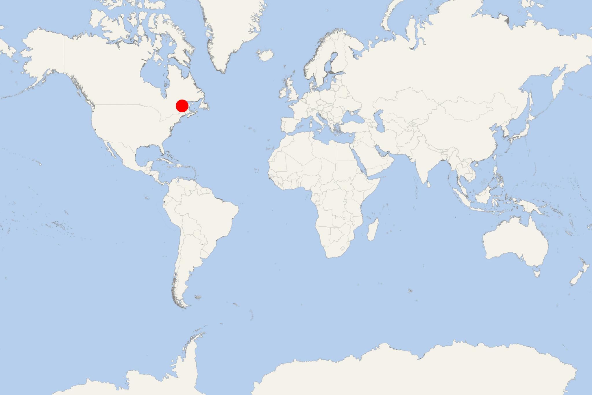
St Lawrence Seaway (Canada)
Cruise Port schedule, live map, terminals, news
Region
Canada and USA Rivers
Local Time
2026-01-22 09:41
 20°F
20°F -6.7°C

 Gentle breeze
3.8 m/s
 27 °F / -2 °C
 15 °F / -9 °C
Port St Lawrence Seaway cruise ship schedule shows timetable calendars of all arrival and departure dates by month. The port's schedule lists all ships (in links) with cruises going to or leaving from St Lawrence Seaway, Canada. To see the full itineraries (ports of call dates and arrival / departure times) and their lowest rates – just follow the corresponding ship-link.
| Day | Ship | Arrival | Departure |
|---|---|---|---|
| 15 April, 2026 Wednesday | |||
| 24 April, 2026 Friday |
St Lawrence Seaway is an inland waterway system consisting of locks, river canals and shipping channels. It is part of both USA and Canada, and permits ocean-going (large-sized) ships to navigate from the Atlantic Ocean to the Great Lakes (as far as Lake Superior).
The St Lawrence River flows from Lake Ontario to the Atlantic Ocean. Saint Lawrence Seaway extends from Montreal to Lake Erie (Port Colborne) and includes the Welland Canal. This section consists of several river channels, locks and canals along the banks of the river. They were constructed to bypass the river's rapids and dams along the route.
Some of the locks are managed by Canadian authorities ("Saint Lawrence Seaway Management Corp") and some by the USA ("Saint Lawrence Seaway Development Corp"). The Seaway is advertised as part of "Highway H2O". The river section downstream of Montreal is fully Canadian and regulated by Transport Canada (Port of Quebec).
Great Lakes-St Lawrence Seaway shipping generates annually over USD 3,4 billion in revenue, with annual economic activity around USD 35 billion, cargo traffic approx 160 million tons, over 237,000 supported jobs.
- Inbound shipments include mostly steel (approx 6% of the USA's total).
- Outbound shipments include grain (approx 7% of the total cargo and approx 4% of USA's overseas total grain shipments).
- Toll revenue from ocean-going ships is approx 30%.
- The main cargoes shipped through St Lawrence Seaway are US grain, liquid bulk, coal, cement and clinkers, steel slabs, stone, ores (mainly iron ore), concentrates, pig iron (crude iron).
- The largest US cargo ports on the Great Lakes Seaway are in Wisconsin (Green Bay, Milwaukee), Michigan (Detroit) and Ohio (Toledo, Ashtabula).
The Seaway locks match the Welland Canal's locks, permitting passages of ships with max LOA length 740 ft (230 m) and max beam (width) 78 ft (24 m). A Seaway locks expansion project is planned for 2030, to allow boxships (container carriers) to navigate to Great Lakes. The expanded Seaway's max air clearance/height is 150 ft (46 m) due to river bridge restrictions (Mackinac, Ambassador, Blue Water, Gordie Howe). The new max draft will be 36 ft (11 m), compared to the current 27 ft (8,2 m).
Currently, Montreal Port allows max drafts of 36 ft (11 m) in St Lawrence River's estuary.
"Cruise the Saint Lawrence" is a Canadian association representing travel agents and cruise tourists, as well as the 9 river- and ocean ports in the region/on the waterway. The list of ports includes Montreal, Quebec City, Trois-Rivieres, Saguenay, Baie-Comeau, Sept-Îles, Gaspe, Havre-Saint-Pierre and Iles de la Madeleine/Magdalen Islands. During season 2017 were reported nearly 0,54 million passengers and crew visiting the 9 St Lawrence cruise ports. Of those, 387,678 were passengers and 151,362 were crew. In 2018, the region was operated by 26 cruise companies and 35 different ships.
In 2018-Q3 (March-September), shipping volumes on St Lawrence Seaway increased 4,1% (over 2017-Q3) driven by increased Canadian grain exports (11,6% increase, to total 5,1 million tons) and improved salt shipments (total 1,9 million tons). Waterway's overall cargo tonnage totaled 25,7 million tons. Overseas cargo traffic increased 81%. The highest volumes were reported at ports Thunder Bay Ontario (total 5,4 million cargo tons) and Hamilton Ontario (109% grain, 40% petroleum products, 38% finished steel, 25% metallurgical coal, 11% fertilizers).
In season 2023 (April 23rd through November 5th) St Lawrence river ports handled 45 cruise ships and ~460,000 cruisers (~40% increase over 2022's 266,601).
For season 2024, Cruise the Saint Lawrence reported 400+ scheduled voyages (booked berthings from 46 different ships from 29 brands/companies.
The next video is about the waterway's history.
Gulf of Saint Lawrence
Gulf of Saint Lawrence is the outlet of North American Great Lakes via St Lawrence River into the Atlantic Ocean. The gulf is actually a semi-enclosed sea that covers an area of nearly 236,000 km2 (91,000 mi2). This unique waterway contains around 35,000 km3 (8,400 mi3) of water, resulting in an average depth of 148 m (486 ft).
Perce Rock ("Rocher Perce", on the above photo) is a huge rock formation (reddish-gold limestone and shale) located on the Gaspe Peninsula's tip. It is considered one of St Lawrence Gulf's (and Quebec's) natural icons and is a major tourist attraction in the region. The "Pierced Island" is linked to the mainland by a sandbar. The town of Perce is on Perce Bay. The famous reef is approx 800 m from downtown, where smaller-sized ships can be moored.
St Lawrence Gulf borders to the north with Labrador Peninsula, to the east with Newfoundland Island, to the south with Nova Scotia Peninsula, and to the west with Gaspe Peninsula, New Brunswick, and Quebec. The largest islands in the Gulf are Anticosti, Prince Edward Island, Magdalen Islands (Quebec), Cape Breton Island, Saint Pierre and Miquelon (France).
Besides St Lawrence River, major rivers that empty into the Gulf are Miramichi, Natashquan, Romaine, Restigouche, Margaree, and Humber, The Gulf's branches include the bays Chaleur, Fortune, Miramichi, St George's, also Bay of Islands and the Northumberland Strait.
The list of national parks / Canadian Government-protected areas along the Gulf includes Forillon National Park (Gaspe Peninsula), Prince Edward Island National Park, Kouchibouguac National Park (New Brunswick), Cape Breton Highlands National Park, Gros Morne National Park (Newfoundland) National Park Reserve (Cote-Nord, Quebec).
St Lawrence River was first sailed by a European in 1534 - the French explorer Jacques Cartier (1491-1557) who claimed current-day Canada's territory for France. He named it "The Country of Canadas", after the indigenous word for "settlement" / "village". At just about the same time, Basques started whale-hunting and trade with modern-day Quebec and the rest of the Atlantic provinces.
St Lawrence Seaway cruise terminal
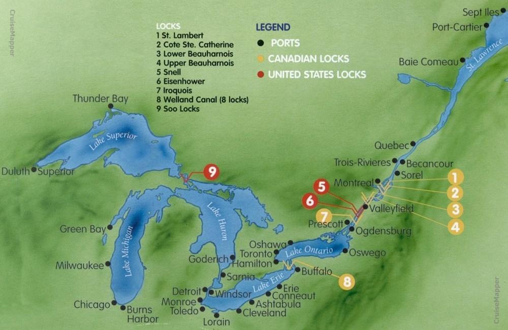
The next photo shows the map of St Lawrence Seaway, with the location of all its ports and locks in USA and Canada.
- Cruise Industry
Victory Cruise Lines/VCL returns to Great Lakes and Canadian waters
Victory Cruise Lines/VCL, a boutique operator specializing in small-ship voyages, is preparing to re-enter the U.S. market this April with a renewed...
April 20, 2025 - Cruise Industry
Ponant’s icebreaker Le Commandant Charcot sets sail for first-ever winter cruise along St. Lawrence...
An icebreaking cruise ship commenced its inaugural winter voyage along the St Lawrence River on Friday, January 17th, offering passengers a unique...
January 19, 2025 - Cruise Industry
HAL-Holland America unveils expanded 2026 Canada & New England itineraries
HAL-Holland America Line will expand its Canada and New England USA season in 2026, adding more cruises, call ports, and overnight port stays. The...
October 15, 2024 - Cruise Industry
Azamara expands Fall 2024 cruises to Canada and New England USA
The ultra-luxury travel brand Azamara has revealed two upcoming sailings for the fall of 2024, expanding its itinerary program to include new ports...
January 14, 2024 - Cruise Industry

Ponant's icebreaker Le Commandant Charcot to become the first cruise ship traversing Canada’s St...
In 2025, the renowned French cruise line, PONANT, boasting a fleet of 13 small expedition vessels, will introduce an extraordinary opportunity to...
August 6, 2023 - Cruise Industry
Port Thunder Bay (Ontario Canada) to host 15 cruise ship calls in 2023
In season 2023, Thunder Bay (Ontario, Canada) is set to accommodate 15 cruise ship visits, a double increase compared to the 9 calls it handled in...
July 10, 2023 - Cruise Industry
Canada moves from voluntary to mandatory measures governing cruise ship wastewater discharges
Government officials in Canada announced a significant change in regulations regarding cruise ship wastewater discharges, emphasizing the need to...
June 26, 2023 - Cruise Industry

Ponant's Le Commandant Charcot to operate winter cruises in St Lawrence 2025
Cruise St Lawrence has announced that in 2025, Ponant's expedition cruise ship, Le Commandant Charcot, will embark on four 12-night sailings on the...
June 21, 2023 - Cruise Industry
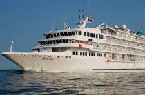
Pearl Seas Cruises announces major interior redesign of its Pearl Mist ship
To celebrate the opening of the 2023 season, Pearl Seas Cruises announced a complete interior redesign of its Pearl Mist ship. The company has...
April 1, 2023 - Cruise Industry

Pearl Seas Cruises announces the 2022 cruise season aboard Pearl Mist
The travel brand Pearl Seas Cruises announced the beginning of its 2022 season aboard the 210-passenger ship Pearl Mist. The company will celebrate...
May 8, 2022 - show more news
